


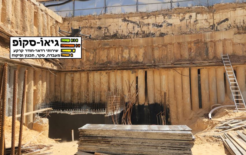
Underground Engineering Element Mapping
Foundations: Detailed mapping of building oundations for stability and structural integrity
Slopes and Retaining Walls: Assess and map slopes and retaining walls to ensure safety and compliance
Fill Thickness: Accurately measure and map fill thickness for construction and land development projects
Road and Railway Inventory Mapping
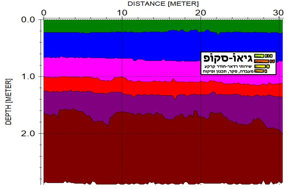
Surface Layers: Precise mapping of road and railway layers, even those just a few centimeters thick
Geological Layers: In-depth geological mapping up to several tens of meters deep, essential for infrastructure planning and maintenance
Underground Infrastructure Mapping
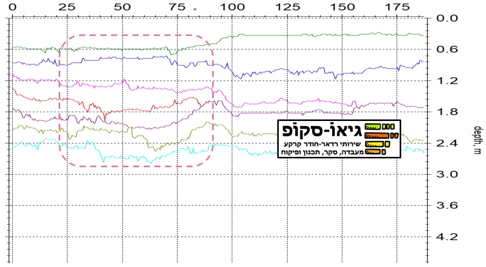
Pipes and Conduits: Detect and map plastic, asbestos, metal and concrete pipes, crucial for utility management and renovation projects

Water and Sewage Leak Detection
Leak Source Identification: Locate and identify the source, direction, and concentration of water and sewage leaks
Reservoir and Dam Inspections: Ensure the integrity of water reservoirs, dams, and transport infrastructures by detecting potential leaks
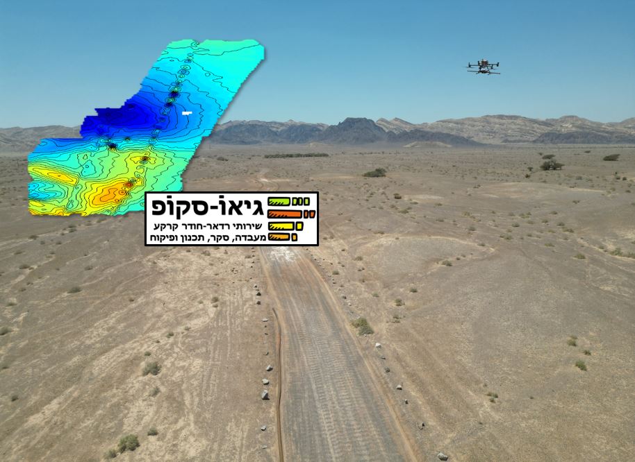
Groundwater Detection and Measurement
Saturation Percentages: Accurately measure groundwater depth and saturation levels, vital for water resource management

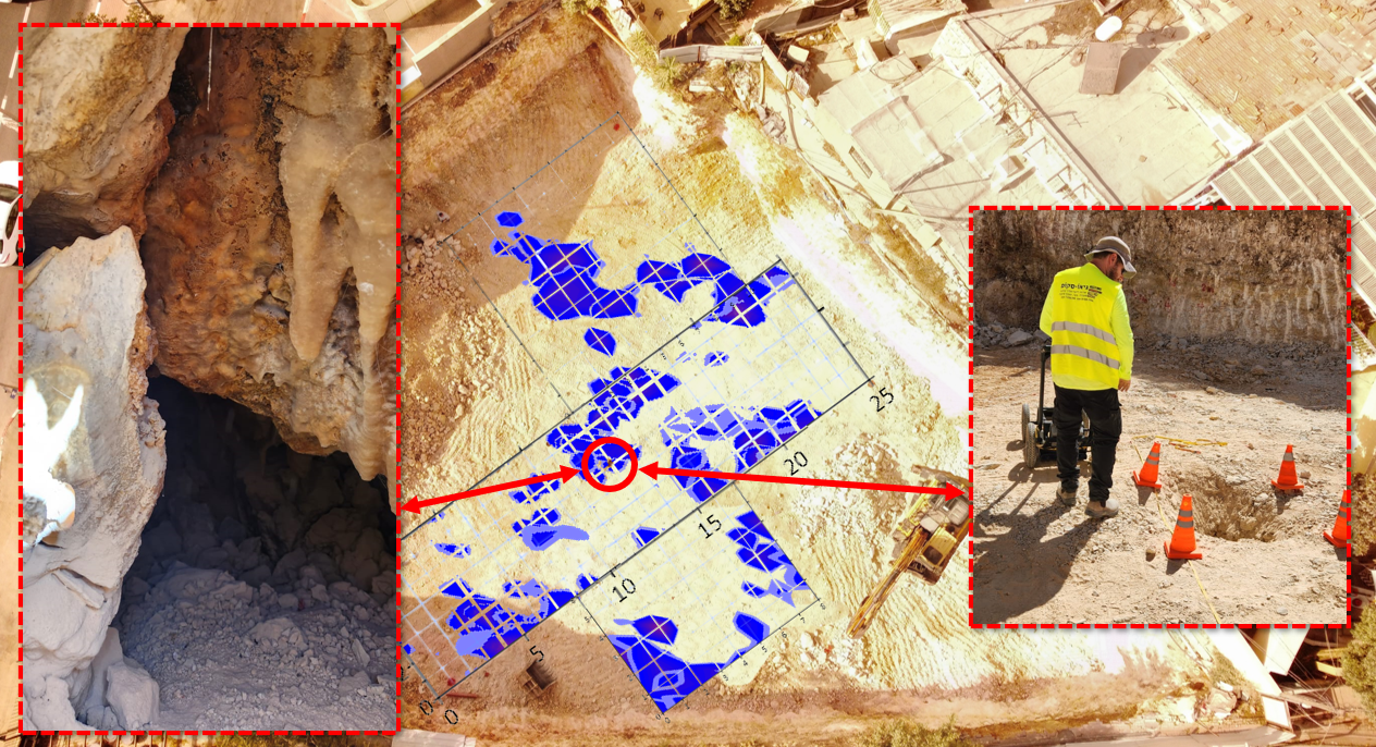
Sinkhole Prevention and Investigation
Pre-Formation Detection: Detect and map plastic, asbestos, metal and concrete pipes, crucial for utility management and renovation projects
Post-Formation Analysis: Locate and analyze the source of sinkhole problems after they occur

Underground Space Mapping
Air, Water, Clay, and Minerals: Map underground spaces, including air pockets, water bodies, clay layers, and mineral deposits
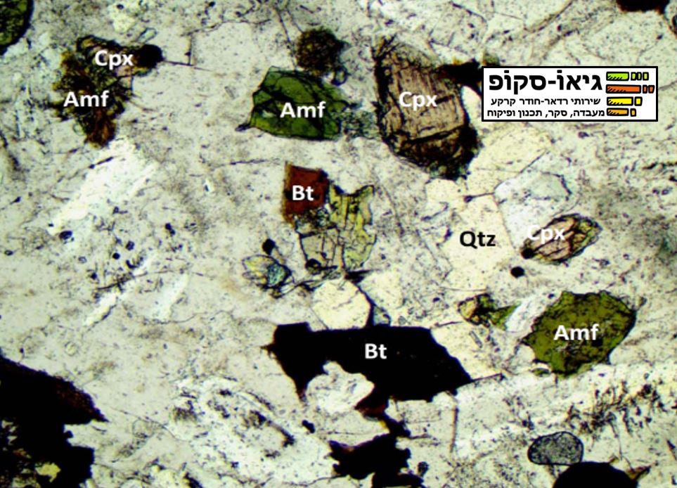
Geological Resource Mapping
Mineral Depositsers: Conduct geological mapping for mineral deposits, gas, oil, and precious metals
Petrological Laboratory Services: Complement our mapping with laboratory analysis, drilling, and quarry planning
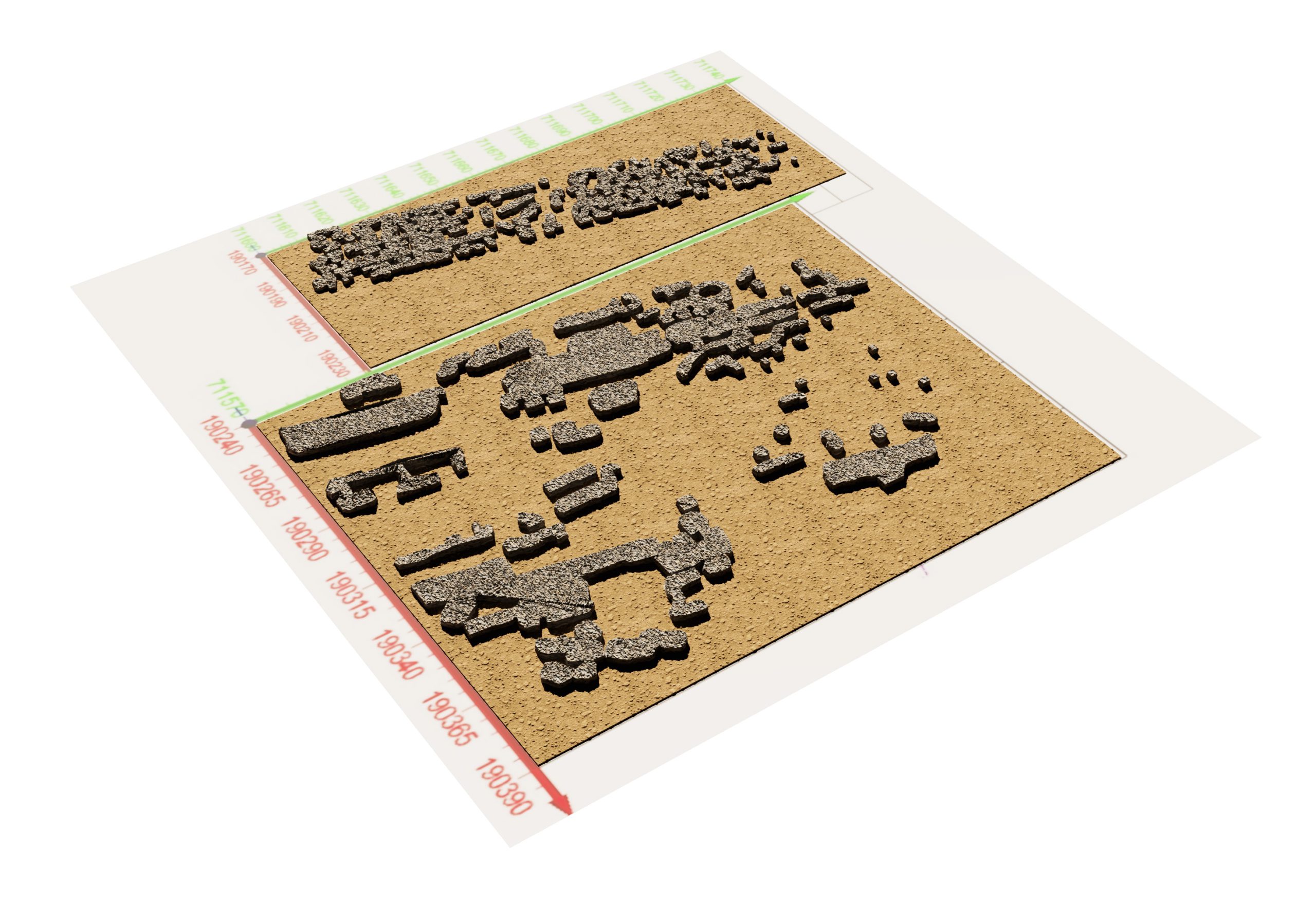
Buried Object Detection
Antiquities and Mines: Locate buried objects such as archaeological sites, mines, and unexploded ordnance
Topographic Mapping
Water Bodies: Perform topographic mapping of riverbeds, lakes, and shallow seas to aid in environmental and infrastructural projects
Slope and Wall Mapping
Slope Mapping: Detect and map potential slope failures and sliding areas by analyzing saturation percentages and ground or rock cracks
Supporting Wall Mapping:Identify and map vertical wall types (piles, foot wall, gravity wall, combined stone wall, etc.) and locate failures behind them, such as abnormal water concentrations or air spaces